Site Analysis
Understanding all the features of a site, using and protecting the best, and minimising the impact of the worst.
Plants, trees and landscape features
Plants, trees and landscape features provide shade and wind shelter, help with stormwater and erosion control, provide a habitat for native or other wildlife and can make a site more attractive.Having access to green spaces increases the physical and mental wellbeing of building occupants.
On this page:
- site considerations
- plants as a passive design tool
- using plants to control stormwater runoff
- retaining/removing trees
- considering the environment
- gathering information.
Site considerations
When assessing the existing topography and vegetation of a site, considerations include:
- access to winter sun
- the amount of shading required
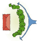
- provision of shelter from strong, cold winds
- enhancement of cooling breezes
- privacy
- existing biodiversity
- planted species – native or introduced
- age of the existing planting.
Plants as a passive design tool
Plants and trees can assist the passive design of buildings by:
- providing shade
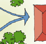
- funnelling breezes where cooling is required
- providing shelter from intrusive winds
- reducing glare by filtering summer sun
- having species that let in winter sun during cooler weather
- helping manage stormwater runoff.
If the site is large or complex, or has other issues that require specialist advice, a landscape architect should be consulted in the early stages of the design process.
Using plants to control stormwater runoff
Plants can play an important role in reducing runoff and removing contaminants in runoff. Water-loving plants can be planted in swales (wide and shallow drainage channels) or in rain gardens. Some new Auckland suburbs have rain gardens in place of the grass verges seen in older suburbs. Slightly below road level, rain gardens are filled with plants such as rushes and irises that love water. They slow down rainwater runoff, reducing the likelihood of street flooding, and they help purify the runoff.
On a larger scale, mature trees can reduce the volume of rainwater hitting the ground in the first place. Trees catch rainwater, holding it in their canopies and allowing it to gradually evaporate from there. This “canopy interception” for large trees has been found to average around 500–650 litres per tree, per storm in American research. Approximately 20–40% of rainfall can be caught by a large tree canopy, preventing it from reaching the ground and the stormwater system. Retaining and planting trees can therefore make a substantial contribution to reducing flood risk.
Retaining/removing trees
Removing trees and other vegetation may:
- require permission from the local council
- alter drainage patterns
- increase risks of erosion and land slippage
- result in increased exposure to pollution and noise from adjacent roads.
Some trees are protected under local authority district plans and require resource consent to be pruned or cut down.
It is easier to retain existing trees and plants than to restore an area of planting. Where possible, planting should be retained and protected during the construction process. If a mature tree must be removed, relocation may be a better solution than removing it.
Considering the environment
Before removing trees from a site, consider their value to the environment and/or the community.
Long areas of planting provide corridors for wildlife to move between areas of bush and encourage native species that improve biodiversity.
Streams and wetlands provide food or shelter to local wildlife, and streambanks can also provide corridors through which wildlife can move.
Gathering information
Observation of the site and adjacent sites will provide information about the types of trees and plants that grow well in an area, and their effect on wind and sun on the site.
A land information memorandum (LIM) or property information memorandum (PIM) may have information about trees and plants on the site, and the district plan may have information about protected trees and plants.
Aerial photographs and geographical information can be/and Google Earth.
Updated: 29 May 2023


